Warning: file_get_contents(./upload/2015/09/23/20150923095919-8998a3d9.jpg): failed to open stream: No such file or directory in /web/hbrook-datacat/htdocs/photos/piwigo/include/functions_picture.inc.php on line 146
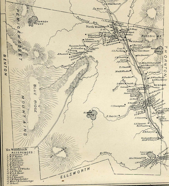
"Town of Woodstock from Hurd's 1892 Atlas of New Hampshire"
4/5
Home / Research Facilities (watersheds, met stations, buildings, maps) / Maps /

"Town of Woodstock from Hurd's 1892 Atlas of New Hampshire"
woodstock_1892.jpg Map of logging campsThumbnails"Hubbard Brook area on Walling's 1860 Map of Grafton County"Map of logging campsThumbnails"Hubbard Brook area on Walling's 1860 Map of Grafton County"Map of logging campsThumbnails"Hubbard Brook area on Walling's 1860 Map of Grafton County"Map of logging campsThumbnails"Hubbard Brook area on Walling's 1860 Map of Grafton County"Map of logging campsThumbnails"Hubbard Brook area on Walling's 1860 Map of Grafton County"Map of logging campsThumbnails"Hubbard Brook area on Walling's 1860 Map of Grafton County"Map of logging campsThumbnails"Hubbard Brook area on Walling's 1860 Map of Grafton County"

"Image shows the town of Woodstock. Water bodies, roads, and houses are featured, along with a generalized topography. Owner names are written beside most houses. This image is part of a complete scan of the the map at Plymouth State University done in 2004 as part of a land-use history project with Steve Hamburg."

Author
"Matthew Vadeboncoeur"
Dimensions
1600*1753
File
woodstock_1892.jpg
Filesize
521 KB