Warning: file_get_contents(./upload/2015/10/11/20151011131610-5e54d372.png): failed to open stream: No such file or directory in /web/hbrook-datacat/htdocs/photos/piwigo/include/functions_picture.inc.php on line 146
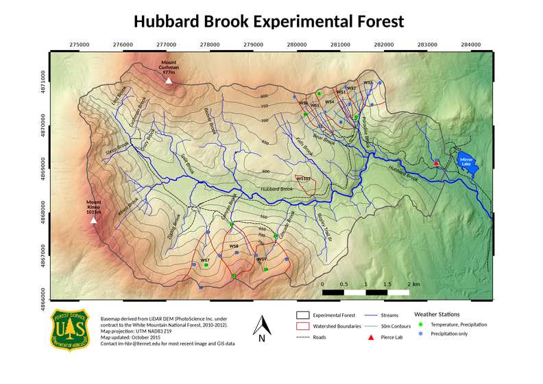
HBEF map 20151010
1/5
HBEF_map_20151010.png Thumbnails"HBEF Map"Thumbnails"HBEF Map"Thumbnails"HBEF Map"Thumbnails"HBEF Map"Thumbnails"HBEF Map"Thumbnails"HBEF Map"Thumbnails"HBEF Map"

Map of Hubbard Brook Experimental Forest. Background is shaded relief from
LiDAR surface elevation. Full resolution image for large format printing, and original data layers available from im-hbr@lternet.edu.

Author
Mary Martin
Dimensions
3507*2481
File
HBEF_map_20151010.png
Filesize
7317 KB
Tags
LiDAR, Map